SketchUp INTEGRATION
The SketchUp INTEGRATION module makes it possible to export elements from windPRO to the standalone software SketchUp (©Trimble Inc.), including background maps, elevation data, calibrated photos from PHOTOMONTAGE, Shape files, result layer raster data, CFD results, Solar PV areas, rotating WTGs and much more. In addition, 3D elements can be exported back from SketchUp and visualized in PHOTOMONTAGE.
windPRO SketchUp INTEGRATION requires a licensed access to the standalone software SketchUp. SketchUp can be purchased directly via their website – from which you can see prices and read further details on the software
-
Creative Freedom
Work in a SketchUp version of the windPRO project. Download or create 3D elements and bring it back into windPRO PHOTOMONTAGE -
Show windPRO Projects in 3D
View and edit a windPRO project in SketchUp and view it on phones or tablets. Prepare for VR or AR applications -
Visualize Shadows from WTGs
Export WTGs to SketchUp and show them rotating and casting shadows -
Show Calculation Results in 3D
Result layers can be shown as 3D volumes. CFD results can be shown as quiver plots -
Place photos in SketchUp
Use windPRO's PHOTOMONTAGE to position any photo in 3D space and continue visualizing in SketchUp -
Browse Camera Viewpoints
Quickly browse from camera position to camera position in your 3D model

Complete creative freedom for PHOTOMONTAGE users
SketchUp is known for its intuitive user interface, and it is easy to create any kind of 3D elements needed in a Photomontage. Also, models can be downloaded from the huge 3D warehouse or imported from many file formats, including DWG and DXF. With a single click, anything in SketchUp can be copied back into windPRO as a 3D object and used directly in PHOTOMONTAGE.
Shadows can be shown correctly on the PHOTOMONTAGE photo, using SketchUp’s shadow visualization features.

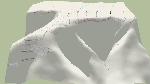
Show windPRO project in 3D
Create a 3D representation of a windPRO project in the world’s most popular 3D application. Show rotating turbines in a landscape defined by windPRO background maps and elevation data. PV plants can easily be defined in windPRO and exported. Free viewers are available to view a SketchUp project on different devices like phones and tablets. Also, different applications can view projects as AR or VR.
windPRO has several build-in worldwide maps and additionally it handles WMS, TMS, world files, GeoTiff, Google Earth overlays and manually georeferenced maps. These can now be exported to SketchUp with a few clicks.
All the many sources of elevation data that is directly available in windPRO, can now be exported to SketchUp. Also, elevation data can be loaded and exported from many file formats e.g., Surfer Grid, GeoTiff, dxf and xyz files.
windPRO supports all common coordinate systems and can export those definitions to SketchUp as well.

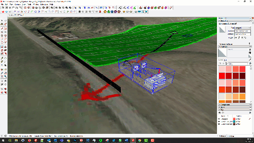
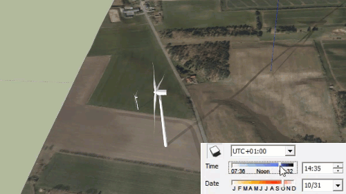
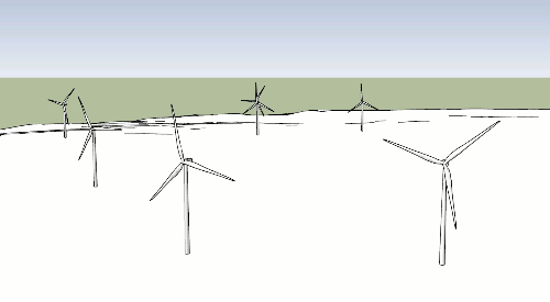
Visualize WTG shadows
Export WTGs to SketchUp and watch them rotate and casting shadows. Shadows can be shown on the ground or on other objects in the model using SketchUp’s advanced shadow calculator where date and time can be user defined. Obstacles can be exported at building positions and used as shadow receptors. This is great for visualizing and estimating WTG flicker.

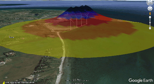
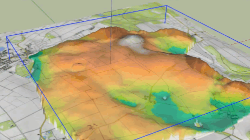
Show calculation results in 3D
Result layers (raster data) can be shown as 3D volumes on top of the elevated surface. This provides a unique and informative representation of the data.
CFD results can be shown as quiver plots using a flexible exporter setup.

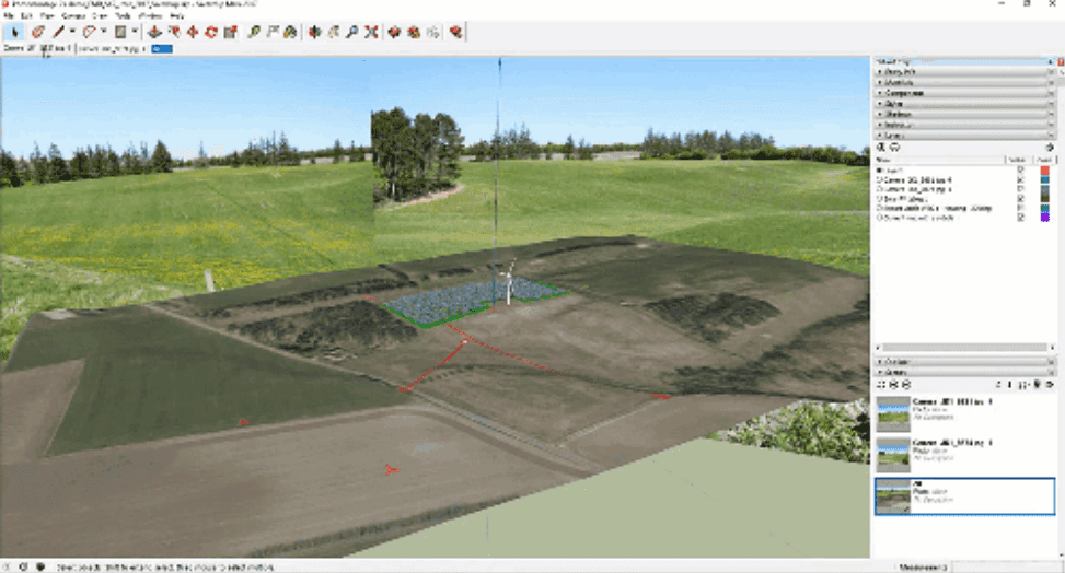
Place photos in SketchUp
Use the sophisticated calibration tools in windPRO PHOTOMONTAGE to position any photo in 3D space with great precision. This makes it easy for SketchUp users to create visualizations on photos and place objects correctly using GIS coordinates in any system.
The PHOTOMONTAGE calibration toolbox includes horizon line, surface wiregrid, pointing out known control points on a photo and running automatic customized optimizations of camera parameters and optimizing one camera using other cameras.

Browse camera viewpoints
Quickly browse from camera position to camera position in your 3D model. Show your model from any coordinate defined by your windPRO camera. Create animations flying from position to position.

Improved Export capabilities
Everything in SketchUp can be saved in Google Earth .kmz format for easy sharing. This means that everything that is exported to SketchUp can be shown in Google Earth. This includes PV plants in 3D, result layer volumes, CFD quiver plots and windPRO background maps.