Which displacement heights are you applying for your in-forest wind farm?
ETH forest canopy heights – global coverage and high-resolution – now in windPRO!
If you are analysing wind farms at forested sites in any part of the world, then a high-resolution canopy height dataset is now available: “Global Sentinel-2 10m Canopy Height (ETH Zurich)”. The dataset is created by a team of ETH researchers using an artificial neural network (by fusing the two data-sources of GEDI and Sentinel 2 by application of a probabilistic deep learning model).
The data is representative for the forest heights within year 2020. The 10m grid resolution dataset is already released and available from our windPRO online-data services – and analysis-ready to work with the forest models in windPRO: The displacement height calculator and the Object Roughness Approach (ORA).
Read more:
- Global Sentinel-2 10m Canopy Height (ETH Zurich)
- windPRO Global Satellite Imagery – 10m
- Other windPRO online-datasets
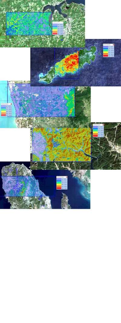
Sample Images:
Images are showing the new “Global Sentinel-2 10m Canopy Height (ETH Zurich)” dataset on top of the updated “windPRO Global Satellite Imagery 2022” as the background map. Data being shown are canopy heights with existing wind turbine locations in various parts of the world: Nova Scotia (Canada), Tobago (Trinidad & Tobago), Hainan (China), Yeonzo-ri (South Korea) & Izmir (Turkey). Grid squares on the maps are 5km x 5km.
Data Acknowledgement:
A high-resolution canopy height model of the Earth (ETH Global Canopy Height 2020) by authors: Nico Lang, Walter Jetz, Konrad Schindler and Jan Dirk Wegner. Documentation is available at arXiv: 2204.08322.